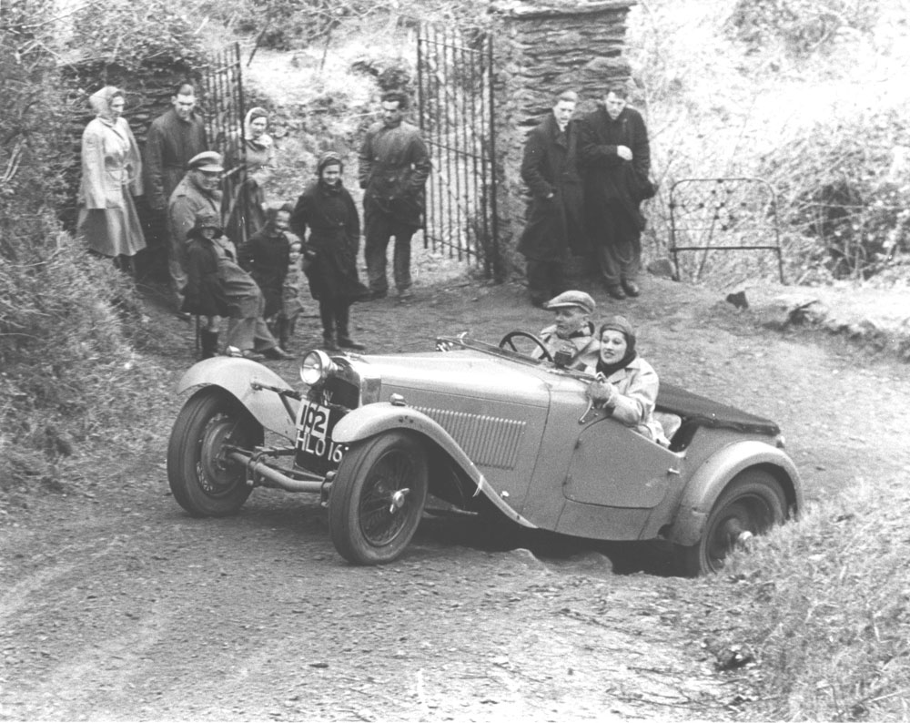
 I’ve had this photo for a long time and, indeed, published it some years ago on a previous version of this website, but I must confess that I’ve lost my note of the original source (Nigel Brown? John Salter?) and some of the key information (such as who?). Whatever, it is an HRG and is, I believe, on the 195o Lands End Trial. The question is where?
I had lengthy, but ultimately inconclusive, email exchanges with both Nigel and John about this photo back in September 2011. I have a note that the 1950 Lands End sections were, in alphabetical order: Barton Steep (ST), Beggars Roost, Doveyhay (m/c only), Hookway, Southernwood, Station Lane (Hill), Stoney Street, and Yealscombe; but the Motor Sport report also mentions Ashwell so I wonder if my list is correct?
We eliminated all except Hookway based on our knowledge of the others, but couldn’t match the photo with the section known as Hookway and used by the Silverton Motor Club for their Exe Valley Trial up to 1998 (Silverton used the track west-to-east with the section start at https://bit.ly/348MSPe).
So … does anyone know where this is? Or can anyone at least confirm that No.102 was an HRG in 1950, which might help to confirm the year and, therefore, the ‘long list’ of sections to choose from?
Update 26 September 2019 18:00:
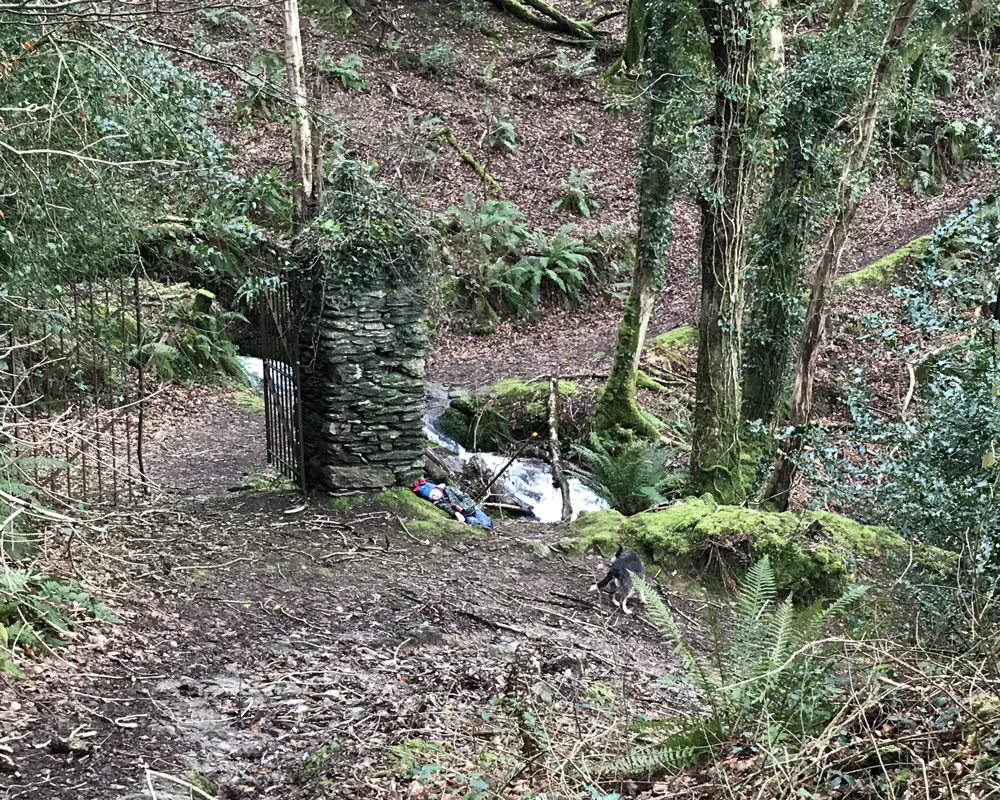
Well … it is the 1950 Lands End Trial, and it is D.C.S.Bassett in an 1100cc HRG on Lyn Hill near Barbrook in North Devon (the list of 1950 sections, above, is obviously incomplete). Lyn Hill starts on the B3234 at OS GR SS 7196 4859 and heads south east to end at OS GR SS 7245 4827. It is clearly shown as an ORPA on the current OS Maps. Lyn Hill was used for the Lands End Trial in 1949 and 1950 only and, according to my source, the bridge over the West Lyn River was washed-away in the infamous 1952 Lynmouth Flood and was subsequently rebuilt as a non-vehicle bridge. Which explains why the hill was never used again. The pillars and gates are still, apparently, in situ on the sharp left-hand hairpin bend clearly shown on the OS maps.
If you view the B3234 on Google Street View, heading uphill towards Barbrook, you can clearly see the bridge in the valley on the left-hand side just uphill from the Olde Cottage Inne.
Update 18 February 2020 12:00:

I’ve just received the above photo from Jo Goodman (of the Goodman family who own the wonderful Barbrook Filling Station, well-known to all who’ve done the Lands End Trial). I think this is final and conclusive proof that the photo of the HRG is most definitely on Lyn Hill, as described above. Are those really the same gates as were there 70 years ago? They certainly look identical!