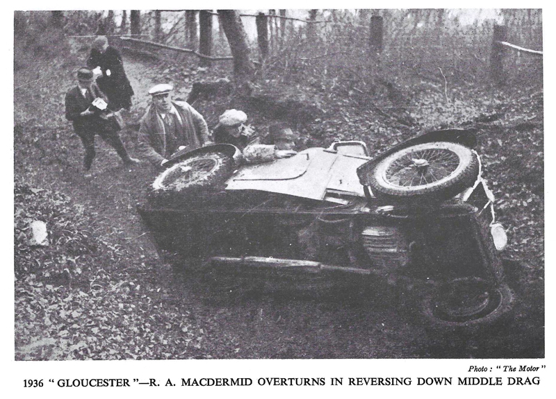
The Cotswolds section known as “Middle Drag” has achieved something of a mythic status over the years despite being used, as far as I am aware, only twice, for the 1936 Fedden and 1936 Gloucester Trials. The myth must have started with the photo above, reproduced from C A N May’s classic “Wheelspin“, reinforced by the Bristol MC’s video of the 1936 Fedden (available on YouTube). Both events were reported in detail in the magazines of the time, and by May in “Wheelspin”, and Middle Drag was clearly a formidable hill ranking alongside Juniper as a “Cotswold Terror”.
But where was it? I don’t have route cards for either of the 1936 events and the magazine reports only refer to it as “rising from the village of Dursley”. For a long time I assumed (but only as a ‘best guess’) that it might be the road currently known as The Broadway, which climbs from the centre of Dursley up onto Stinchcombe Hill. Recently, by chance, I was talking to Stroud&DMC member Peter Hayward who was searching the Dursley area for possible new hills for the Mechanics Trial. He had been talking to (former Marlin owner) John Hammill, who lives on Stinchcombe Hill. John then produced some correspondence he’d had with a Dursley resident who confirmed that the track (now Dursley Bridleway 63) rising from Fort Lane (off Woodmancote) had been called “The Drag” in his youth (in the 1930s). Peter and I have both now walked this track and it does bear a striking resemblance to the track shown in the 1936 photos and video. Not a 100% positive identification, but highly likely to be Middle Drag unless anyone can prove otherwise.
The foot of the section, where Fort Lane becomes Bridleway 63 is here.
Q. Does “Middle Drag” = “Fort”?
A. No!
Those of you with a detailed knowledge of historic sections in the Cotswolds, particularly the Dursley area, will immediately ask the question above. But see the answer. Sections known variously as Fort, Fort 1, and Fort 2, featured in the Gloucester Trial in the 1930s, the Fedden Trial in the 1940s, the Guy Fawkes and Allen Trials in the 1950s and 60s, and the Cotswold Clouds Trial from 1962 to 1978. But, in all cases, the approach was up Nunnery Lane, not Fort Lane (I have many of the route cards). For those not familiar with the area, Nunnery Lane is the fork-right when you fork-left up Twinberrow Lane to approach Crooked Mustard during the Cotswold Clouds Trial.
I believe that one or both of the “Fort” sections were in-or-around the quarry on the left at the top of Nunnery Lane, or maybe on Nunnery Lane itself. This fits the frequent route card instruction at the top of Fort 1 to “return to the foot of the hill” before attempting Fort 2. The exit was always left onto the road at the top (the road which passes the tops of Crooked Mustard and Axe).
But why “Fort”? Fort Lane (+ Bridleway 63) and Nunnery Lane join at the very top, where they meet the road onto Stinchcombe Hill, so “Fort” must have some historic significance but, if it does, a comprehensive Google search has revealed nothing. OK, there are the remains of an Iron Age hillfort at Drakestone Point, but this is right at the far end of Stinchcombe Hill, well away from the top of Nunnery Lane. Does anyone with a detailed knowledge of Dursley’s history know why Fort Lane is so-called?